

Zones We Cover
Explore the major Delhi planning and Land Pooling zones, including K-I, L, N, P-I, P-II and Zone J, along with the R Zone master-plan GIS reference.
Delhi Planning Zones
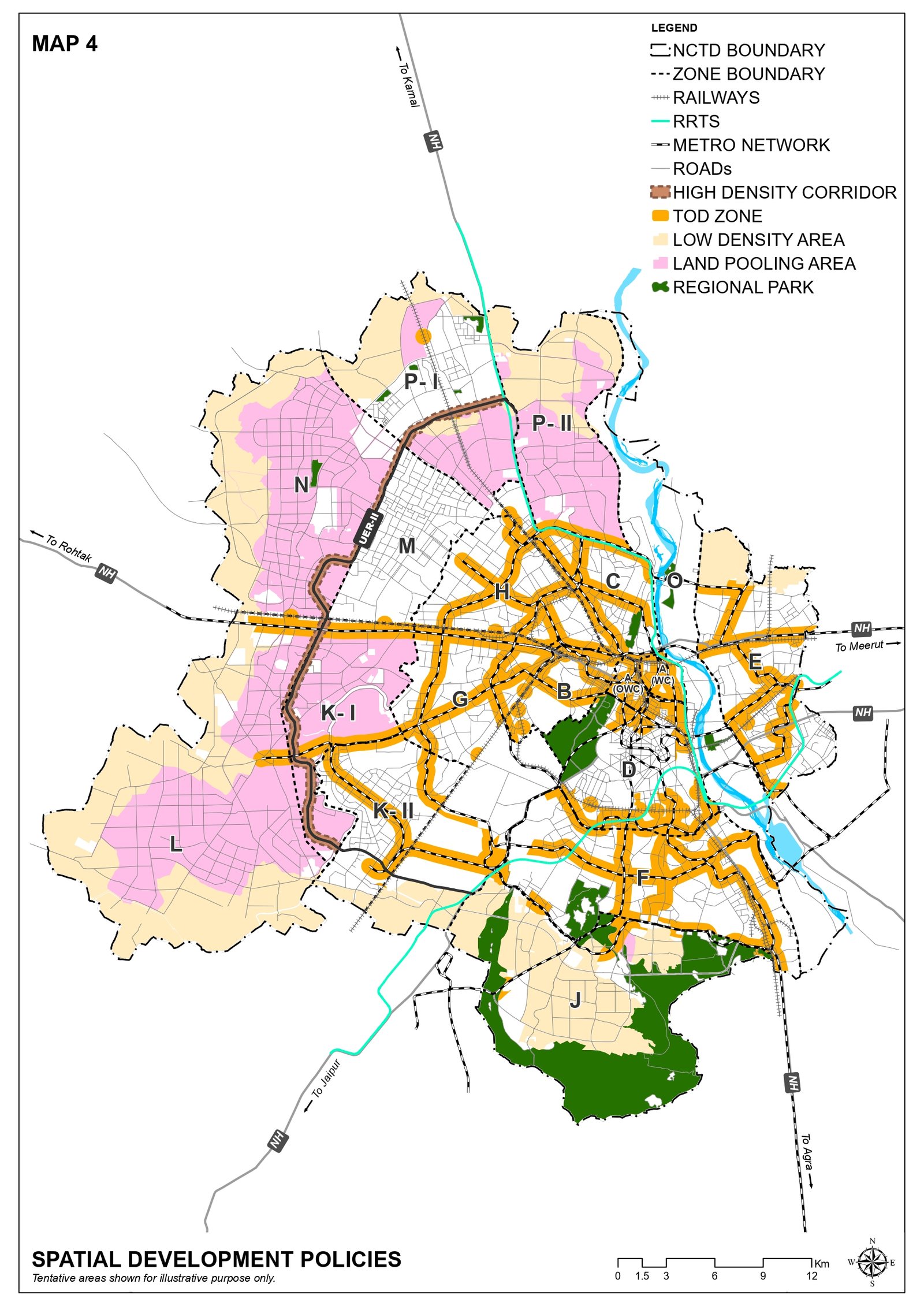
Delhi's Land Pooling framework applies to notified urban-extension areas across multiple planning zones. Each zone has its own sector delineation, road network, planning boundaries and development context.
The sections below allow visitors to understand each zone separately and view the available DDA sector delineation plan.
Zones Covered
Zone K-I
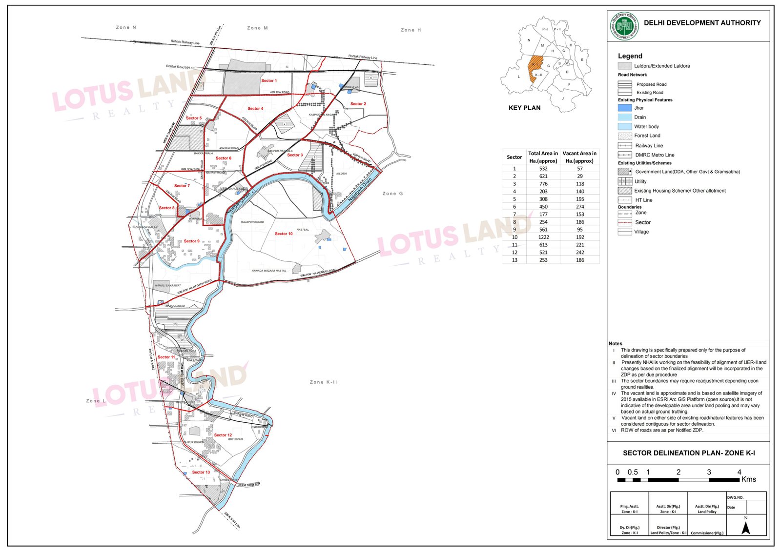
Zone K-I is one of the planning zones included in Delhi's Land Pooling urban-extension framework. The DDA sector delineation plan divides the zone into individual sectors and identifies important road alignments, existing settlements and other planning features.
It is also one of the zones connected with the UER-II High Density Corridor framework discussed under Delhi's wider planning strategy.
Use the DDA sector plan to understand sector boundaries and the broad planning context. Individual land eligibility should always be verified against current DDA and revenue records.
Zone L
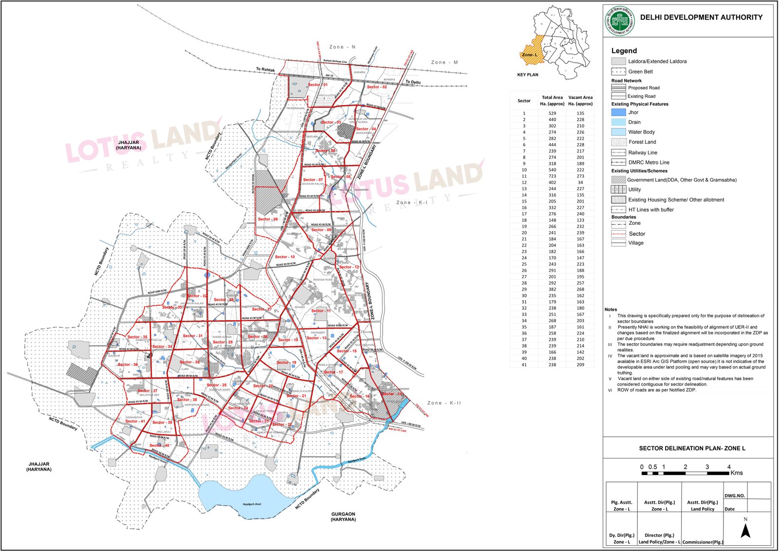
Zone L forms part of the western and south-western urban-extension planning area and is included in the Land Pooling framework.
The sector delineation map shows the sector network, village areas, proposed roads, physical features and other planning boundaries used for sector-level development planning.
Any investment decision should be based on the exact village, khasra, sector location, title status and current DDA planning records.
Zone N
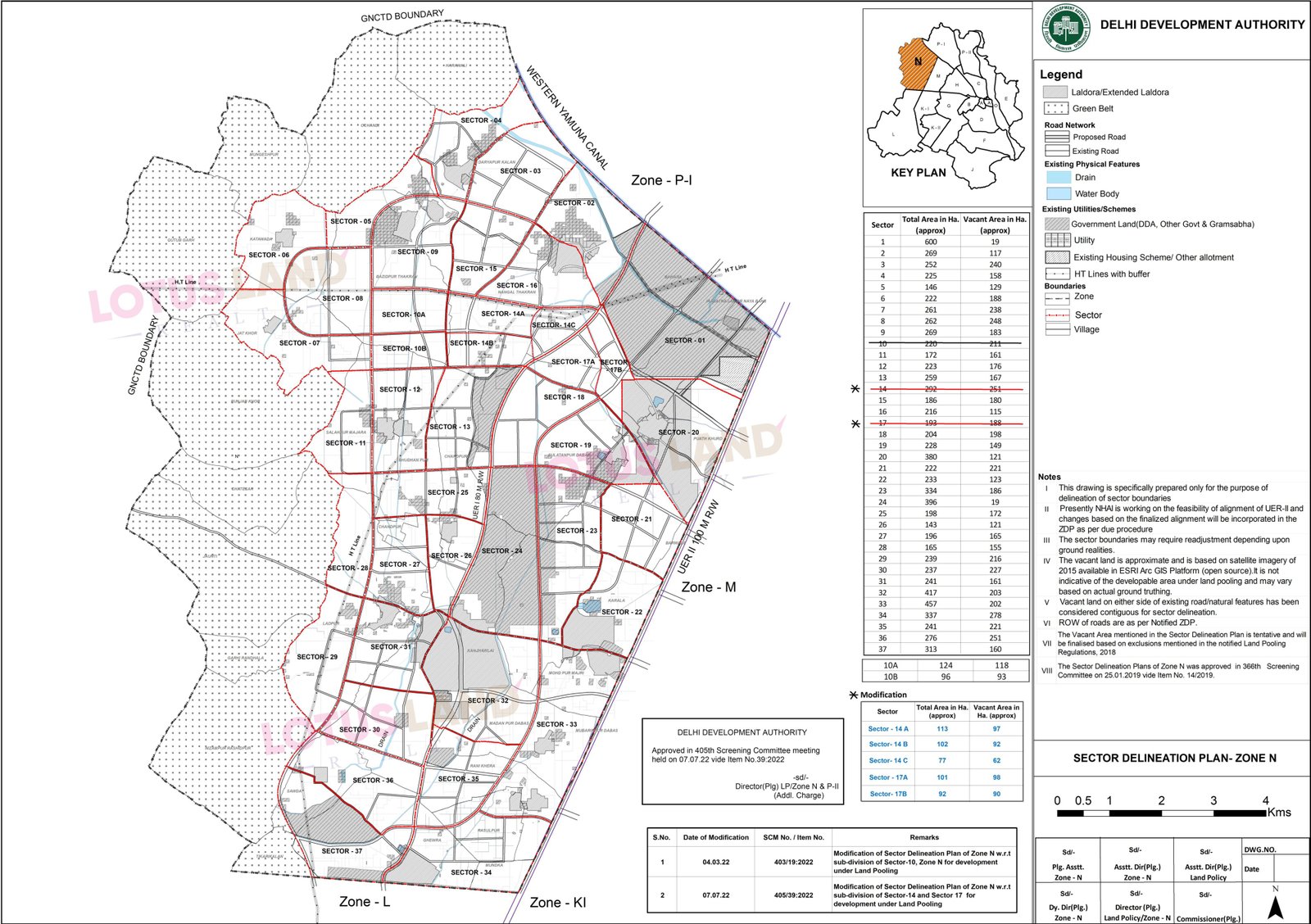
Zone N is a major north-west Delhi planning zone included in the Land Pooling urban-extension area. The sector delineation plan identifies the proposed sector structure and associated road network.
The map also provides a useful reference for understanding the relationship between villages, sector boundaries, vacant areas and existing development.
A sector map is a planning reference and does not by itself confirm the development or investment status of an individual parcel.
Zone P-I
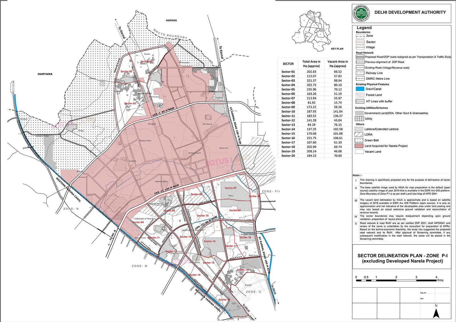
Zone P-I is part of Delhi's northern planning area. DDA's reference material identifies the relevant sector delineation separately from the developed Narela Project area.
The map shows proposed sector boundaries, major roads, physical features, existing utilities and the wider relationship with adjoining planning zones.
DDA also publishes sector-wise pooled-land maps for Zone P-I. The sector plan shown here is the broader delineation reference.
Zone P-II
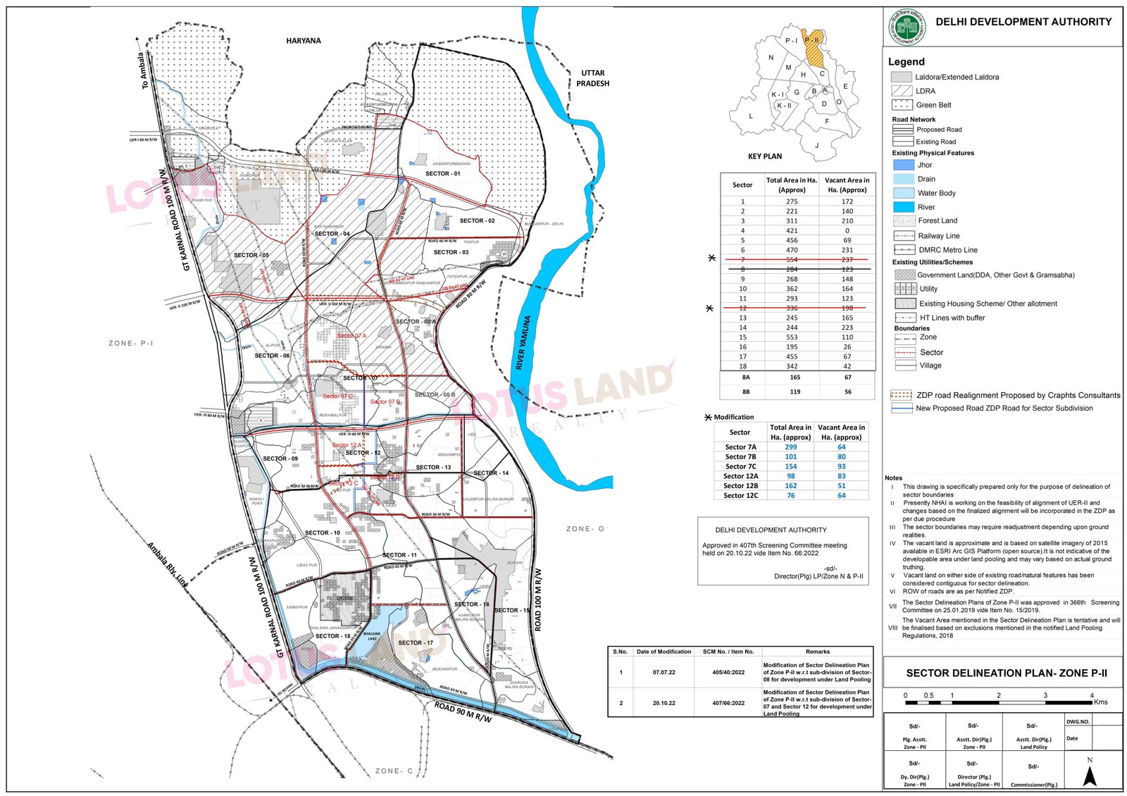
Zone P-II is another important north Delhi urban-extension zone under the Land Pooling planning framework.
The DDA sector delineation plan identifies individual sectors, road alignments, village boundaries, green-belt areas, physical features and other existing development conditions.
DDA publishes sector-wise maps for pooled lands in Zone P-II in addition to the broader sector delineation plan shown here.
R Zone
For R Zone, use the Delhi Development Authority's GIS master-plan reference to explore planning and land-use information directly on the official interactive map.
The GIS viewer provides a more detailed spatial reference than a static image and can be used to inspect the mapped planning context.
R Zone should be treated separately from the Land Pooling zones listed above; planning or investment claims should be verified against the current DDA master-plan and GIS records.
Need Help Understanding a Zone?
Contact Lotus Land Realty for guidance regarding zone, sector and location-specific land opportunities and for assistance understanding the available planning references.